Hello,
We are trying to re-project the coral reef dataset via ogr2ogr for
the dataset to fit the bluemarble projection. The coral reef is a vector
shape dataset and it is using the Lambert Cylindrical Equal Area at -160
central meridian. Once we re-project we are getting lines connecting the
shapes that are cutoff at the edges from -180 to 180. Is that a bug ?
or are we doing something wrong?
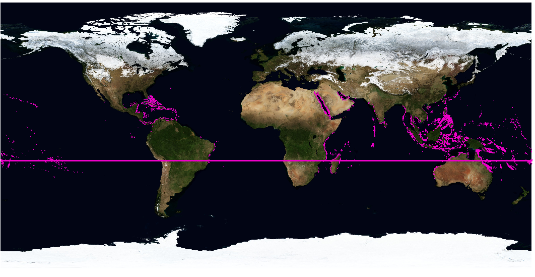
You can see the offset issue here
http://dukodestudio.com/client_room/coralreefs/coralReefData-offsetlineissue.png
Here is the location of the dataset
http://www.wri.org/publication/reefs-at-risk-revisited#datasets
Our command is as follows:
ogr2ogr -s_srs '+proj=cea +lon_0=-160 +lat_ts=0 +x_0=0 +y_0=0' -t_srs
EPSG:4326 reefPoly28.shp reef_500_poly.shp
We did try to use the "-spat -180 -90 180 90" flag with the above commnd
but without success.
Thanks, ik.


_______________________________________________
gdal-dev mailing list
gdal-dev@lists.osgeo.org
http://lists.osgeo.org/mailman/listinfo/gdal-dev